Benjamin Horton’s Research Helps Paint Better Picture of Massive 1700 Earthquake

In 1700, a massive earthquake struck the west coast of North America. Though it was powerful enough to cause a tsunami as far as Japan, a lack of local documentation has made studying this historic event challenging. Benjamin Horton, Associate Professor and Director of the Sea Level Research Laboratory in the Department of Earth and Environmental Science, was part of a team that worked to solve this geological mystery through a fossil-based technique. Their work provides a finer-grained portrait of this earthquake and the changes in coastal land level it produced, enabling modelers to better prepare for future events.
Horton’s team included lab members Simon Engelhart and Andrea Hawkes. They collaborated with researchers from Canada’s University of Victoria, the National Taiwan University, the Geological Survey of Canada and the United States Geological Survey. The research was published in the Journal of Geophysical Research: Solid Earth.
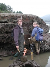
To provide a clearer picture of how the earthquake occurred, Horton and his colleagues applied a technique they have used in assessing historic sea-level rise. They traveled to various sites along the Cascadia subduction zone, where the 1700 earthquake occurred, taking core samples from up and down the coast and working with local researchers who donated pre-existing data sets. Through radiocarbon dating and an analysis of different species’ positions with the cores over time, the researchers were able to piece together a historical picture of the changes in land and sea level along the coastline. The research revealed how much the coast suddenly subsided during the earthquake. This subsidence was used to infer how much the tectonic plates moved during the earthquake.
Their research has implications for the present and the future: The Cascadia Subduction Zone runs along the Pacific Northwest coast of the United States to Vancouver Island in Canada. This major fault line is capable of producing megathrust earthquakes 9.0 or higher. This subduction zone is of particular interest to geologists and coastal managers because geological evidence points to recurring seismic activity along the fault line, with intervals between 300 and 500 years. With the last major event occurring in 1700, another earthquake could be on the horizon. A better understanding of how such an event might unfold has the potential to save lives.
“The next Cascadia earthquake has the potential to be the biggest natural disaster that the Unites States will have to come to terms with—far bigger than Sandy or even Katrina,” Horton said. “It would happen with very little warning; some areas of Oregon will have less than 20 minutes to evacuate before a large tsunami will inundate the coastline like in Sumatra in 2004 and Japan in 2011.”
The research was supported by the National Science Foundation, the United States Geological Survey and the University of Victoria. Simon Engelhart and Andrea Hawkes are now assistant professors at the University of Rhode Island and the University of North Carolina, respectively.
Read the full story here.


